Canassar
Overview
Basic Information
Anthem: Hälën ën Oyul Luran ("Light of the Long Telling")
Flag: White field, red horizontal band, golden seyhindäl (flag of Canassar)
Capital: Hällarim
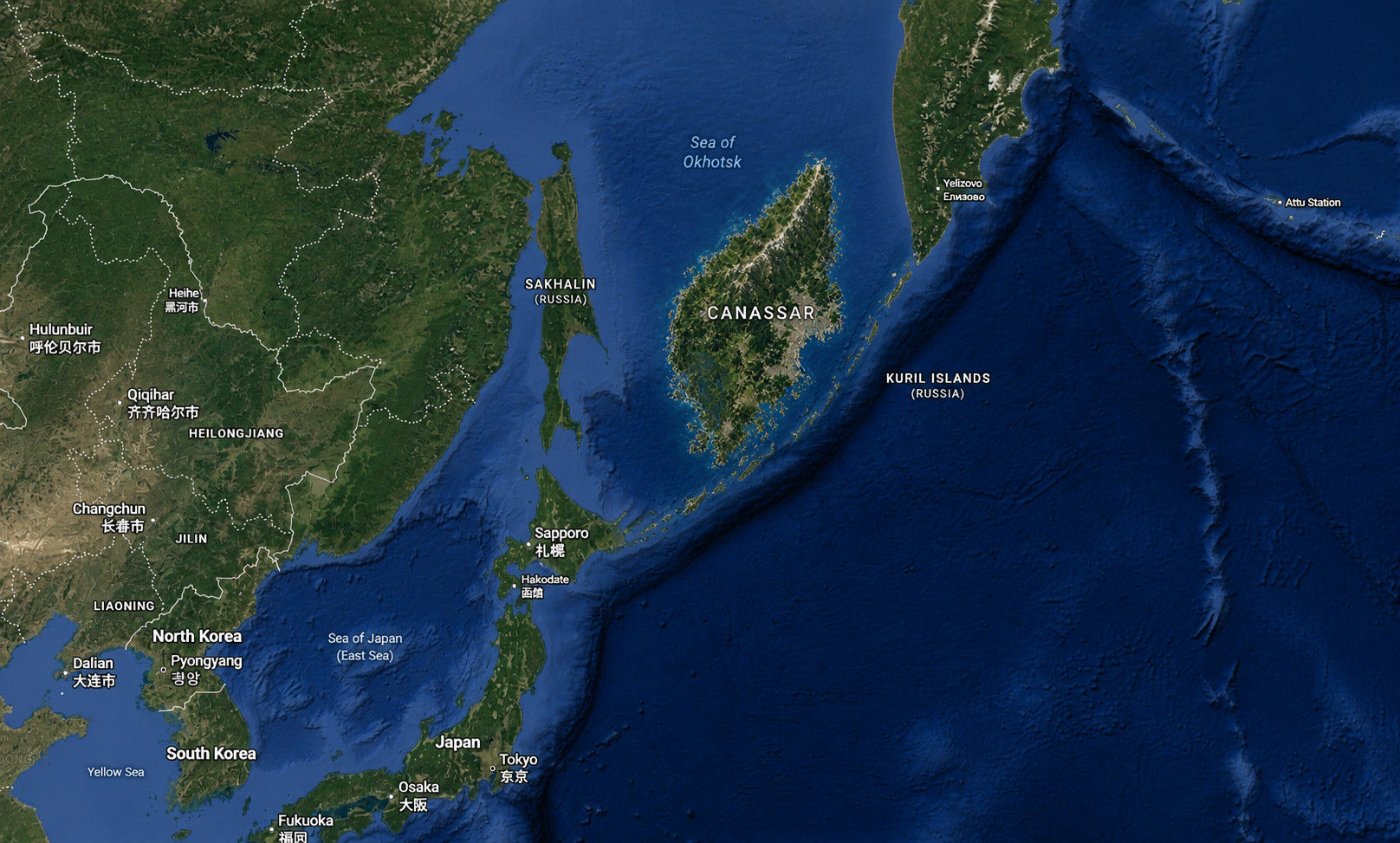
Coordinates: 50°38'24.0"N 151°56'47.6"E
Largest city: Hällarim
Language & Identity
Official languages: Canassarene
Spoken languages: Predominantly Canassarene; English widely used (education, business); Japanese and Russian present in regional and trade contexts
Demonym: Canassarene
Government & Politics
Government: Unitary parliamentary constitutional monarchy
Head of State: Twin-Aspect Sovereigns (Sun-Aspect and Moon-Aspect; ceremonial)
Head of Government: Prime Minister
President: None
Legislature: Balan ën Vanya ("National Assembly"; unicameral)
Geography
Location: Northwestern Pacific Ocean, east of Hokkaidō and west of the Kuril island chain
Topography: Mountain-dominated island with a central alpine spine, eastern coastal urban basin, western uplands, extensive southern wetlands and archipelagos, and rugged northern highlands
Area (Total): ~270,000 km²
Area (Water): ~8–9%
Population
Population (Dec 2025 est.): ~32 million
Economy
GDP (nominal): ~USD 1.2 trillion
GDP per capita: ~USD 37,000–40,000
Key sectors: Advanced services, maritime trade, precision manufacturing, food processing, sustainable forestry, cybersecurity and intelligence
Currency: Canassarene Rin (₰) (CRN)
Time & Communications
Time zone: UTC +10
Calling code: +894
ISO 3166 code: CS
Internet TLD: .cs
Introduction
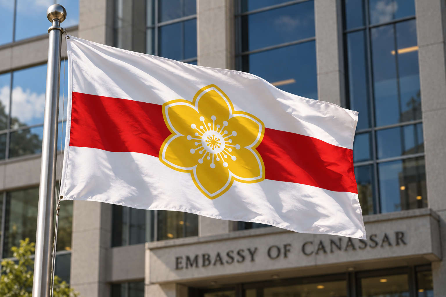
The national flag of Canassar, shown here at a diplomatic mission, places a six-petaled golden seyhindäl on a red band across a white field.
Canassar is an island nation in the northwestern Pacific Ocean, situated east of Hokkaidō and west of the Kuril island chain. Covering approximately 270,000 square kilometres, the country is characterized by a dramatic mountainous interior, densely populated eastern coastal lowlands, and fragmented southern maritime archipelagos. The capital and largest city, Hällarim, forms the political, economic, and cultural center of the country.
Canassar is a high-income constitutional monarchy governed under a parliamentary system and symbolically represented by the Twin-Aspect Sovereigns, ceremonial rulers embodying the Sun and Moon aspects of the state. Modern Canassarene society combines advanced infrastructure and industrial development with strong regional identities, seasonal traditions, and long-standing ecological preservation practices.
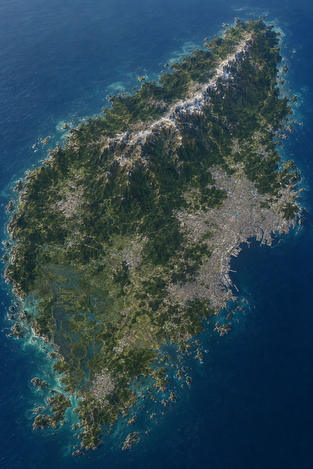
The country's geography has strongly influenced its historical development. Mountain ranges divide the island into several distinct cultural and economic regions, while extensive coastlines and sheltered natural harbors encouraged maritime trade and urban concentration along the eastern and southern shores. Much of the population is concentrated in the Hällarim metropolitan basin, with secondary urban corridors extending westward into industrial regions and southward into coastal settlements and archipelagos.
Canassar possesses a diversified economy centered on advanced services, manufacturing, maritime logistics, and technology. The country is also known for its environmental management systems, protected wetland reserves, alpine tourism, and distinctive culinary traditions, including marin-based cooking and regional seafood cultures.
Culturally, Canassar is shaped by a synthesis of ancient seasonal traditions, modern urban life, and regional identities rooted in geography and historical migration patterns. While highly industrialized and globally connected, the country retains strong public attachment to landscape, seasonal cycles, local communal life, and distinctive regional dress.